
After seeing my crude teenage maps of the White Album, @tedmills sent me the cover of Paul McCartney’s 1986 single, “Press.”
“The world keeps showing me these pictures.”

After seeing my crude teenage maps of the White Album, @tedmills sent me the cover of Paul McCartney’s 1986 single, “Press.”
“The world keeps showing me these pictures.”
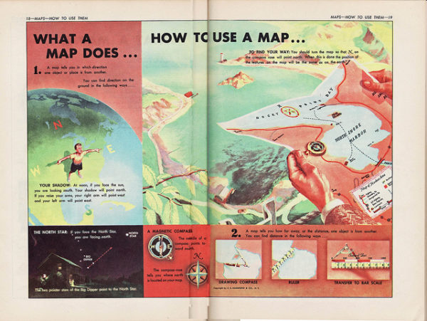
I love maps. I love looking at maps and I love thinking about maps and I love collecting maps.
When I was studying at Cambridge, I was writing essays for my tutor about Dickens and Dostoevsky, and they were just awful. I think my tutor thought I was a moron. (Or just an American student. Same thing.) Then one day I came in with a rough hand-drawn map of the London in Dickens’ Our Mutual Friend. He said my scribbled map was the best work I’d done.
I knew then, I think, that my talent was going to be for using pictures and words together, and maps would serve as useful inspiration. A decade ago, I published a blog post collecting a bunch of fictional maps, and I’m thinking of them again, thanks to a beautiful new book, The Writer’s Map: An Atlas of Imaginary Lands.
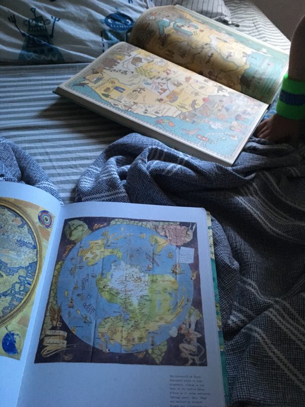
A few bedtimes ago, both the 5-year-old and I were just lying in his bed looking at maps and talking about him. A rare moment of bliss. (His book was entitled, simply, Maps.)
A while back I read an article about how to you have to get children to fall in love with the world before you ask them to save it. (Gary Snyder: “The first step, I think… is to make us love the world rather than to make us fear for the end of the world. Make us love the world… and then begin to take better care of it.”)
Part of the author’s research was looking at maps children of different ages make of their worlds. He describes the cartography of the different age groups:
From ages four to seven, children’s homes fill the center of their maps, and much of their play is within sight or earshot of the home. Children often describe the worms, chipmunks, and pigeons that live in their yards or on their blocks, and they feel protective of these creatures.
From eight to eleven, children’s geographical ranges expand rapidly. Their maps push off the edge of the page, and they often need to attach extra pieces of paper to map the new terrain they are investigating. Children’s homes become small, inconsequential, and often move to the periphery of the map. The central focus in their maps is the “explorable landscape.”
From 12 to 15, the maps continue to expand in scope and become more abstract, but the favored places often move out of the woods and into town. Social gathering places such as the mall, the downtown luncheonette, and the town park take on new significance.
As Michael Chabon once put it, “Childhood is a branch of cartography.”
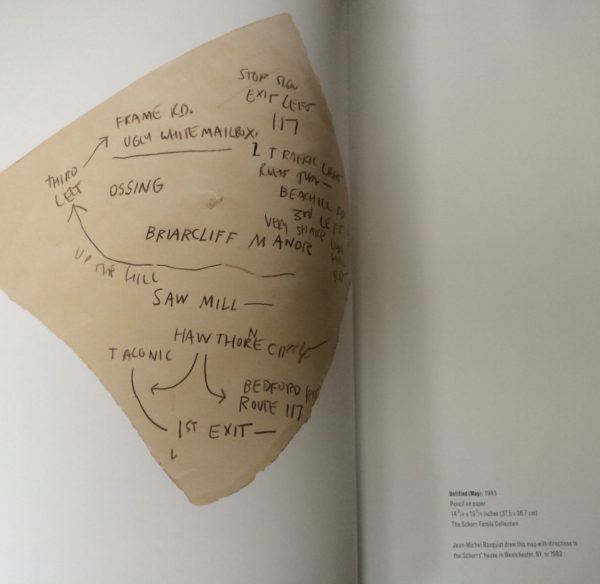
Here’s Rebecca Solnit talking about why she loves paper maps (author of, among other books, A Field Guide to Getting Lost and Infinite City: A San Francisco Atlas):
Maps are ubiquitous in one sense, and completely missing in another. A lot of younger people don’t own maps and atlases and don’t have the knowledge a map gives you. We call things like MapQuest and Google Maps on your phone interactive… but are they? Are they interactive? It’s a system that largely gives you instructions to obey. Certainly, obedience is a form of interaction. (Maybe not my favorite one.) But a paper map you take control of — use it as you will, mark it up — and while you figure out the way from here to there yourself, instead of having a corporation tell you, you might pick up peripheral knowledge: the system of street names, the parallel streets and alternate routes. Pretty soon, you’ve learned the map, or rather, you have — via map — learned your way around a city. The map is now within you. You are yourself a map.
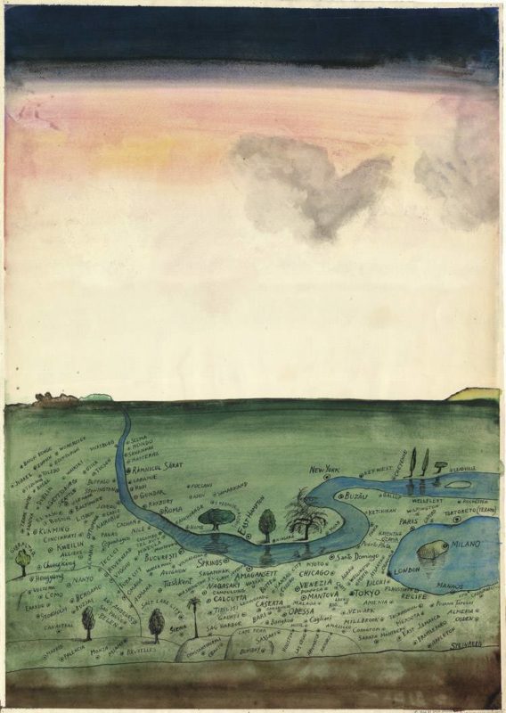
Many of my favorite artists use maps in their work. Saul Steinberg is famous for his view of New Yorker provincialism, but he drew tons of other maps, including the one above, which was never actually published in his lifetime. Beautiful.
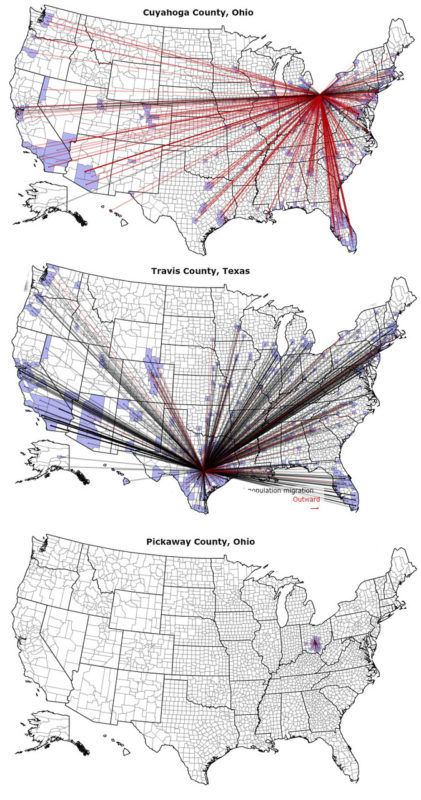
“Maps are arguments,” says Denis Wood. Maps tell stories. (They can also lie.)
Years ago, I found this online migration map that shows you how people move in and out of different counties.
Three maps that tell three stories.
The top map is Cleveland, where I used to live. Everybody’s leaving. It looks like an explosion.
The middle map is Austin, where I live now. Everybody’s moving here. It looks like a black hole.
The bottom map is Pickaway County, Ohio, where I grew up. Hardly anyone leaves. Hardly anyone moves in. It looks like a puddle.
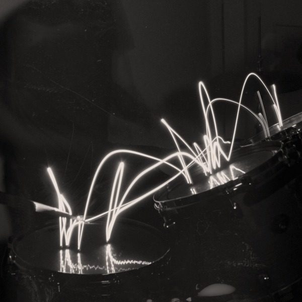
I’m interested in how maps can move beyond geography towards mapping other things in the world. Here’s one of my favorite maps of all-time, from a 2005 Harper’s:
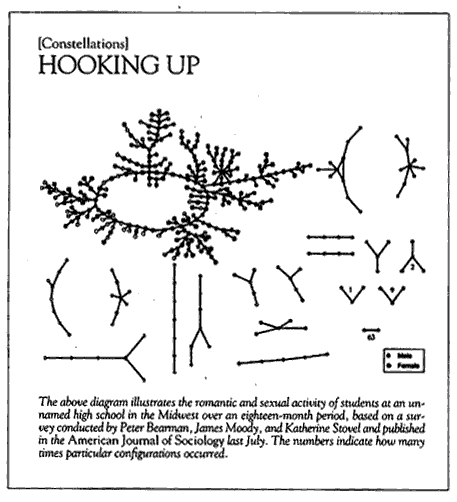
I love looking at those diagrams and thinking about the stories behind them. (For example, where is the single dots, depicting the virgins?)
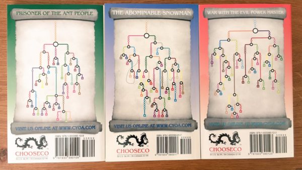
Just this week I became obsessed with the plot maps on the back of new editions of the Choose Your Own Adventure series:
Around the same time I got interested in maps, I discovered “mind mapping,” and started making my own mind maps of the books I was reading:
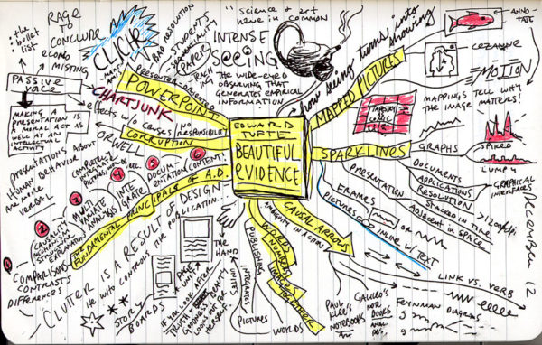
When pictures and words are laid out in the same space — broken out of the linearity of normal type — you can see new relationships between them and come up with new ideas. I find this kind of drawing with pictures and words to often be way more powerful than simply writing longhand.
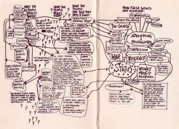
Years ago, I read Peter Turchi’s Maps of the Imagination, and it had a big impact on me. (I later got to interview him about his work.) Turchi suggests that writers are cartographers, in a sense: they help people figure out where they are in the world.
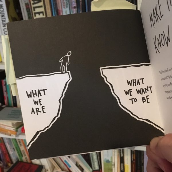
I continue to be taken with this idea. I think of my books as way-finding devices: they show you how to get from where you are to where you want to be.
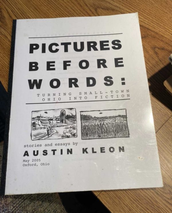
Note: spurred on by Mark’s excellent comment on my “new house” post, I’m posting this excerpt from my undergrad thesis I wrote in the spring of 2005 (pre-blog). The thesis was called “Pictures Before Words,” and it was about using visual thinking techniques like clustering and storyboarding to create prose fiction. It’s surprising to read back through it now, and realize how much it laid out the ideas I would explore in the next 3 years or so: sense of place and writing as world-building, the connection between pictures and words…thanks to Sean Duncan for introducing me to a lot of the material!
* * *
IN CHAPTER FOUR of Dylan Horrocks’ graphic novel, Hicksville, a character named Dylan Horrocks and a character named Grace travel to a land named Cornucopia to meet its greatest cartoonist, Emil Kopen. Upon their meeting, Kopen refers to himself not as a comics writer, but as a “cartographer” or a “maker of maps.” This puzzles Horrocks, and prompts Grace to ask Kopen to explain. Kopen says that comics are the same as maps because they are “using all of language—not only words or pictures.” Horrocks asks Kopen about the purpose of maps.
“Maps are of two kinds,” Kopen explains. “Some seek to represent the location of things in space. That is the first kind—the geography of space. But others represent the location of things in time—or perhaps their progression through time. These maps tell stories, which is to say they are the geography of time.”
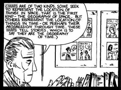
This monologue is quite similar to Scott McCloud’s argument about comics in Reinventing Comics. He argues that space is the form of comics, and time the content: comics work by mapping time.
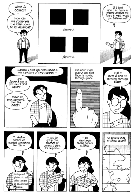
In Horrocks’ online article “Comics, Games and World-Building” (highly recommended) he responds to McCloud’s argument by exploring and expanding the theories of James Kochalka. In Kochalka’s comic, The Horrible Truth About Comics (included in The Cute Manifesto), he proposes an alternative definition of comics to McCloud’s: comics as world-building. “Comics are a way of creating a universe.”
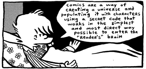
Horrocks interprets:
Now, most discussion about comics (or fiction, for that matter) assumes that their main purpose is to tell a story – a narrative that moves through time; hence McCloud’s description of comics as a “temporal map.” But here, Kochalka seems to suggest something quite different: that comics create a world, a place. Instead of SPACE = TIME, this is SPACE = SPACE.
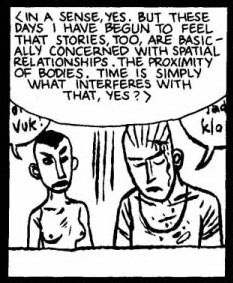
Even those narratives that would seem to be primarily interested with mapping time, with telling stories, or plots, can be seen in spatial terms. Horrocks’ character Emil Kopen explains to the character Dylan Horrocks that along with maps of geography, he feels that “stories, too, are basically concerned with spatial relationships. The proximity of bodies. Time is simply what interferes with that, yes?”
In Writing Fiction, Janet Burroway writes that while plot has often been seen as a type of “power war” or “back and forth” that seems to be going on between characters, “narrative is also driven by a pattern of connection and disconnection between characters that is the main source of its emotional effect.” Connection and disconnection are spatial terms; they imply different degrees of proximity.
Horrocks observes that the notion of “world-building” has mostly been popular within the genre of fantasy (i.e. J.K. Rowling’s Hogwarts, or Tolkien’s Middle Earth). But Horrocks suggests that “all writers are engaged in ‘sub-creation,’ to the extent that all fiction takes place in a ‘Secondary World,’ no matter how closely it may resemble the ‘real world’ in which we live.” No matter what genre you write in, you can use the same world-building techniques used by fantasy artists and writers.
When we read comics and fiction or watch movies, we are asking the artist to take us into a universe of his making. In the words of Kochalka, “When we encounter a great work of art the physical world fades away as we step into this new reality. We are alive in a living world.” This sounds remarkably similar to John Gardner’s idea of fiction as “a kind of dream” that the reader falls into: “We read a few words at the beginning of the book or the particular story, and suddenly we find ourselves seeing not words on a page but a train moving through Russia, an old Italian crying, or a farmhouse battered by rain. We read on—dream on—not passively but actively.”
If writers and cartoonists accept the idea that what they must first do to create a convincing narrative is world-build, the next step is to wonder how they might go about such a thing.
Alan Moore, in the chapter entitled “Worldbuilding; Place and Personality” in Alan Moore’s Writing for Comics, suggests that world-building simply means coming up with the working details of your world and environment before you actually go about writing your story. He suggests coming up with
a mass of information about the world and the people in it, much of which will never be revealed within the strip for the simple reason that it isn’t stuff that’s essential for the readers to know and there probably won’t be space to fit it all in. What is important is that the writer should have a clear picture of the imagined world in all its detail inside his or her head at all times.
Moore suggests that gifted writers will avoid dropping huge amounts of detail on the reader at one time, but instead use these details sparsely in each frame, to suggest that there is a world going on outside of the frames of the comic. This idea parallels Scott McCloud’s theory of closure—“the comics creator asks us to join in a silent dance of the seen and the unseen. The visible and the invisible.” The comics reader is required to fill in the details of the world going on outside the comic panel, and this will succeed only if the world is concretely realized by the creator.
My argument is that the artist can see written fiction, comics, and film as multiple disciplines on the spectrum of storytelling. Although they all have different ideas about what a story is and how you build and present a story, if we accept that what each discipline does is world-build, then we can use the term “world-building” to move fluidly between disciplines. When we have the world-building tools and processes mastered from multiple disciplines of storytelling—whether it be drawing in the case of comics, or writing in the case of fiction—we can use these tools and processes across disciplines to generate the worlds that we imagine.
Recommended reading:
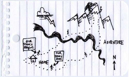
“When I first decided I wanted to be a writer, when I was 10, 11 years old, the books that I loved…came with maps and glossaries and timelines—books like Lord Of The Rings, Dune, The Chronicles Of Narnia. I imagined that’s what being a writer was: You invented a world, and you did it in a very detailed way, and you told stories that were set in that world.”—Michael Chabon, Interview with the AV Club
My undergrad thesis argued that world-building wasn’t just for fantasy and sci-fi writers—every tale has a setting, every tale creates a world in the reader’s mind—and it explored ways that drawing that world (visual thinking!) can lead to better fiction.
Some of my favorite “lit’ry” books are accompanied by maps.
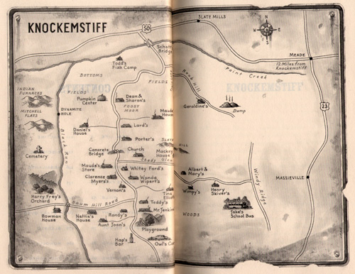
A recent read, Donald Ray Pollock‘s short-story collection, Knockemstiff, is set in the “real” town of Knockemstiff, right outside of Chillicothe, Ohio (30 miles from where I grew up—if you keep heading north on 23 you’ll get to Circleville). The book includes a nice hand-pencilled map by artist David Cain:
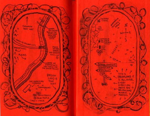
Lynda Barry’s Cruddy contains four maps. Here’s two of them:
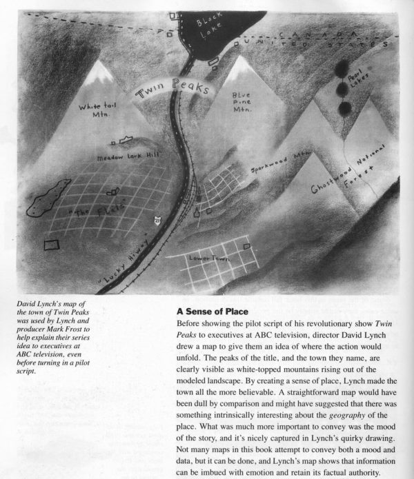
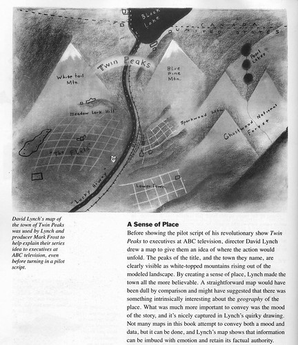
And while it was a TV show and not a book, one of my favorite fictional worlds, Twin Peaks, was drawn by David Lynch for the pitch meeting:
Some writers use previously-made maps to help create their fiction: Melville used whaling charts, Joyce used Ordnance surveys of Dublin, and Pynchon used aerial maps.
Poking around the ‘net I found maps for Faulkner’s books, Treasure Island, and of course, Tolkien.
What other favorite books of yours include maps? Let’s get a big ol’ list going in the comments!

From Nigel Holmes’ out-of-print Pictorial Maps:
Before showing the pilot script of his revolutionary show Twin Peaks to executives at ABC television, director David Lynch drew a map to give them an idea of where the action would unfold. The peaks of the title, and the town they name, are clearly visible as white-topped mountains rising out of the modeled landscape. By creating a sense of place, Lynch made the town all the more believable. A straightforward map would have been dull by comparison and might have suggested that there was something intrinsically interesting avout the geography of the place. What was much more important to convey was the mood of the story, and it’s nicely captured in Lynch’s quirky drawing. Not many maps in this book attempt to convey both a mood and data, but it can be done, and Lynch’s map shows that information can be imbued with emotion and retain its factual authority.
And more from Lynch:
We knew where everything was, and it helped us decide what mood each place had, and what could happen there. Then the characters just introduced themselves to us and walked into the story.
This site participates in the Amazon Affiliates program, the proceeds of which keep it free for anyone to read.